


Hygge by Scandinavia
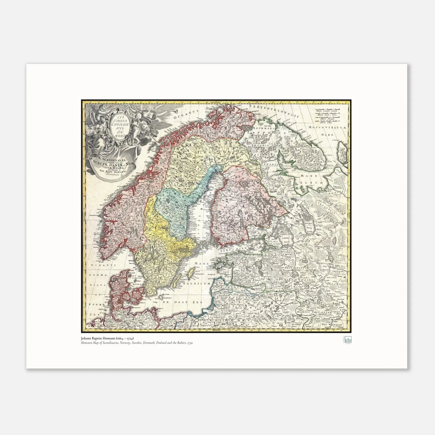
Homann – Map of Scandinavia, Norway, Sweden, Denmark, Finland and the Baltics, 1730 | Historical Map Print
Homann – Map of Scandinavia, Norway, Sweden, Denmark, Finland and the Baltics, 1730 | Historical Map Print
Couldn't load pickup availability
A richly detailed historical map print showing Scandinavia and the Baltic region through an early 18th-century cartographic lens.
Read more
Read more
A richly detailed historical map print showing Scandinavia and the Baltic region through an early 18th-century cartographic lens.
This piece brings together geography, heritage, and decorative depth, making it especially suited to a study, office, library, or calm Nordic interior.
For those with a connection to the North, it offers both visual character and a sense of place.
This historical map print presents Scandinavia alongside Norway, Sweden, Denmark, Finland, and the Baltics in a composition that feels both scholarly and decorative. The visual appeal comes not only from the geography itself, but from the atmosphere old maps naturally bring: detail, texture, borders, typography, and a quiet sense of history.
As wall art, this is a strong choice for rooms that benefit from depth and structure. It works particularly well in a home office, reading room, hallway, or living space where you want something meaningful rather than purely ornamental. The subject matter also gives it a personal dimension for anyone with roots in the Nordic region, an interest in old Europe, or a lasting connection to Scandinavian culture.
The palette and complexity of an antique map print can sit beautifully within both modern and traditional interiors. It adds character without feeling loud. Framed simply, it can feel refined and architectural. In a more layered setting, it brings warmth, memory, and conversation value.
This print also makes a thoughtful gift for heritage buyers, travellers, map collectors, and anyone drawn to Scandinavian history and place-based design. It is a piece that invites a closer look, which is part of its lasting appeal.
Why this print stands out
- Strong Nordic relevance – a map focused on Scandinavia and the wider Baltic area
- Historical character – an old-world cartographic style with depth and visual texture
- Versatile room fit – especially suited to studies, offices, libraries, and calm living spaces
- Heritage appeal – meaningful for those with Scandinavian or Baltic connections
- Gift-friendly – a thoughtful choice for history lovers, travellers, and map enthusiasts
Available poster sizes
| Size (cm) | Size (inches) |
|---|---|
| 30 × 40 cm | 12 × 16 in |
| 40 × 50 cm | 16 × 20 in |
| 50 × 70 cm | 20 × 28 in |
| 60 × 90 cm | 24 × 36 in |
| 70 × 100 cm | 28 × 40 in |
A historical map print that gives Scandinavia a sense of depth, memory, and visual presence.
- Hygge by Scandinavia
Product details table
| Detail | Information |
|---|---|
| Maker / attribution | Homann |
| Subject | Scandinavia, Norway, Sweden, Denmark, Finland and the Baltics |
| Date in title | 1730 |
| Product type | Historical map print |
| Style | Antique cartographic wall art |
| Best suited for | Office, study, library, hallway, living room |
| Available sizes | 100 x 70 cm, 90 x 60 cm, 70 x 50 cm, 50 x 40 cm, 40 x 30 cm |



Created on request - near you.
- We only print when you order, using FSC-certified or equivalent matte paper (200 gsm, 0.26 mm) for a refined, non-reflective finish.
- Local production across the USA, Europe, Australia, New Zealand, and Brazil helps reduce shipping distance and emissions.

Compare size
How is your poster going to look on your wall?
- Choosing a selection results in a full page refresh.
- Opens in a new window.