


Hygge by Scandinavia
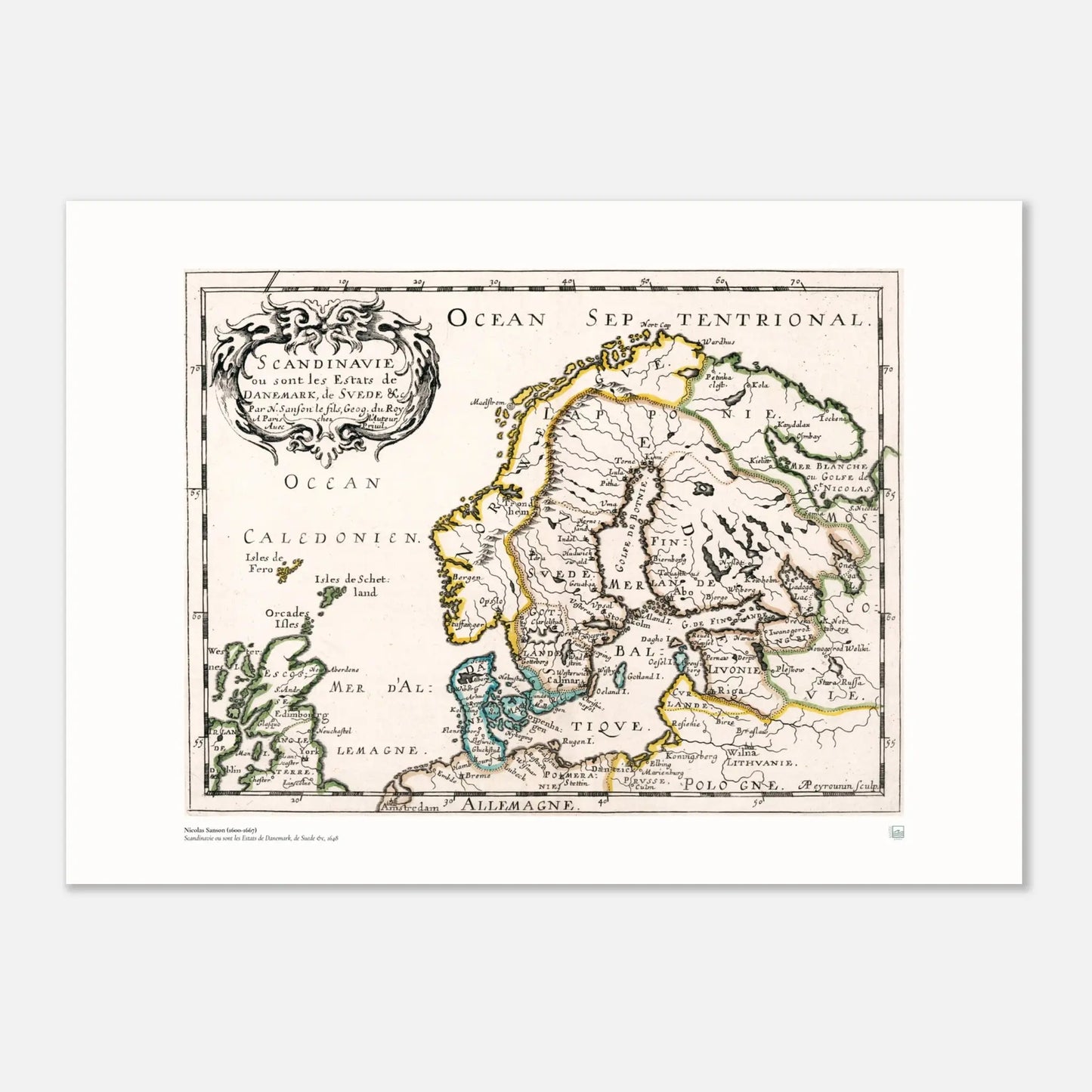
Nicolas Sanson – Scandinavie ou sont les Estats de Danemark, de Suede &c., 1648 | Scandinavian Map Print
Nicolas Sanson – Scandinavie ou sont les Estats de Danemark, de Suede &c., 1648 | Scandinavian Map Print
Couldn't load pickup availability
A historic Scandinavian map print based on Nicolas Sanson’s 1648 atlas map of the region.
This piece brings together Denmark, Sweden, and the wider Scandinavian landscape in a format that feels both scholarly and decorative.
It works especially well in a study, hallway, office, or any home with a love of Nordic history, geography, and old-world detail.
Read more
Read more
A historic Scandinavian map print based on Nicolas Sanson’s 1648 atlas map of the region.
This piece brings together Denmark, Sweden, and the wider Scandinavian landscape in a format that feels both scholarly and decorative.
It works especially well in a study, hallway, office, or any home with a love of Nordic history, geography, and old-world detail.
Scandinavie ou sont les Estats de Danemark, de Suede &c. is a 17th-century map by French cartographer Nicolas Sanson, published in 1648 in Paris. The original was engraved for Sanson’s atlas L’Evrope and presents Scandinavia with political divisions, place names, rivers, mountains, and a decorative cartouche that gives the work its distinctive period character.
As a wall print, this map has a calm historical presence. It offers more than geography alone. It gives a glimpse into how Scandinavia was seen and represented in early modern Europe, while still functioning beautifully as visual decor today. The hand-coloured outline style, engraved detail, and pictorial relief bring texture and depth without feeling heavy.
This is a strong choice for anyone drawn to Scandinavian heritage, antique cartography, or interiors with a thoughtful and collected feel. It suits homes where art is chosen for meaning as much as appearance, and it also makes a considered gift for someone with roots in the region or an interest in Nordic history. This kind of map print fits naturally within your maps collection, where place, identity, and visual heritage come together.
Why this print stands out
- Based on a historic 1648 map of Scandinavia by Nicolas Sanson
- Shows Denmark, Sweden, and the wider Scandinavian region with period political divisions
- Rich in engraved detail, including cities, rivers, mountains, and decorative cartouche work
- Ideal for a study, office, library, hallway, or heritage-inspired interior
- A thoughtful piece for those interested in Scandinavian history, geography, and cultural belonging
Best suited for
- Scandinavian heritage homes
- Offices and studies
- Lovers of old maps and historical prints
- Gift buyers looking for a meaningful Nordic piece
- Interiors with a calm, classic, and collected aesthetic
A map print like this brings Scandinavia into the room not only as a place, but as a story of memory, identity, and visual history.
- Hygge by Scandinavia
| Detail | Information |
|---|---|
| Cartographer | Nicolas Sanson |
| Title | Scandinavie ou sont les Estats de Danemark, de Suede &c. |
| Date | 1648 |
| Place of publication | Paris |
| Type | Atlas map |
| Visual features | Hand-coloured outline, engraved detail, decorative cartouche |
| Region shown | Scandinavia, including Denmark and Sweden |
| Best room fit | Study, office, hallway, library |
Available poster sizes
| Size (cm) | Size (inches) |
|---|---|
| 30 × 40 cm | 12 × 16 in |
| 40 × 50 cm | 16 × 20 in |
| 50 × 70 cm | 20 × 28 in |
| 60 × 90 cm | 24 × 36 in |
| 70 × 100 cm | 28 × 40 in |



Created on request - near you.
- We only print when you order, using FSC-certified or equivalent matte paper (200 gsm, 0.26 mm) for a refined, non-reflective finish.
- Local production across the USA, Europe, Australia, New Zealand, and Brazil helps reduce shipping distance and emissions.

Compare size
How is your poster going to look on your wall?
- Choosing a selection results in a full page refresh.
- Opens in a new window.